Community groups and information
Historical Resources
Information about historical resources for the parish
Historical Parish Maps
Click on a map below for a larger version
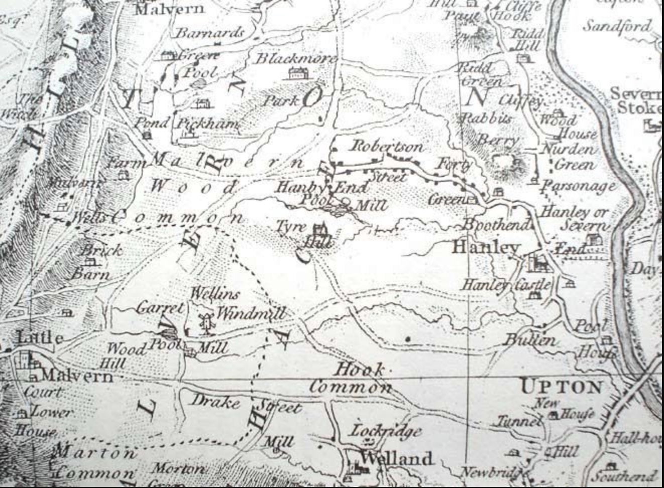
1772 Taylor Map of Hanley Castle
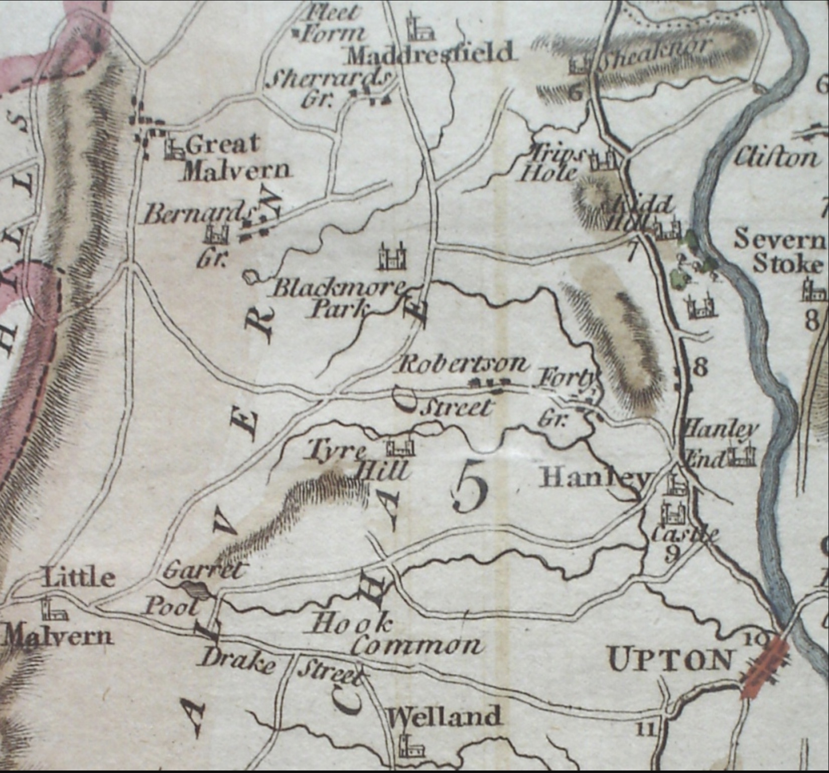
1795 Cary Map of Hanley Castle
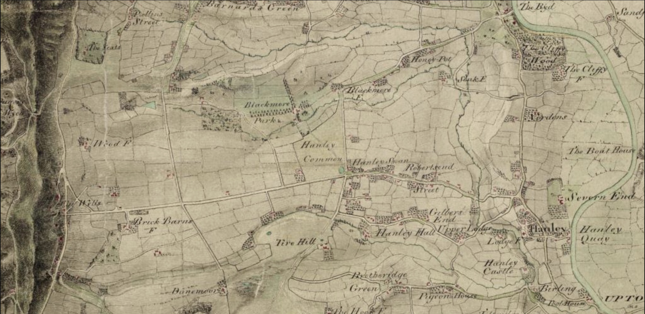
1812 OS Map of Hanley Castle
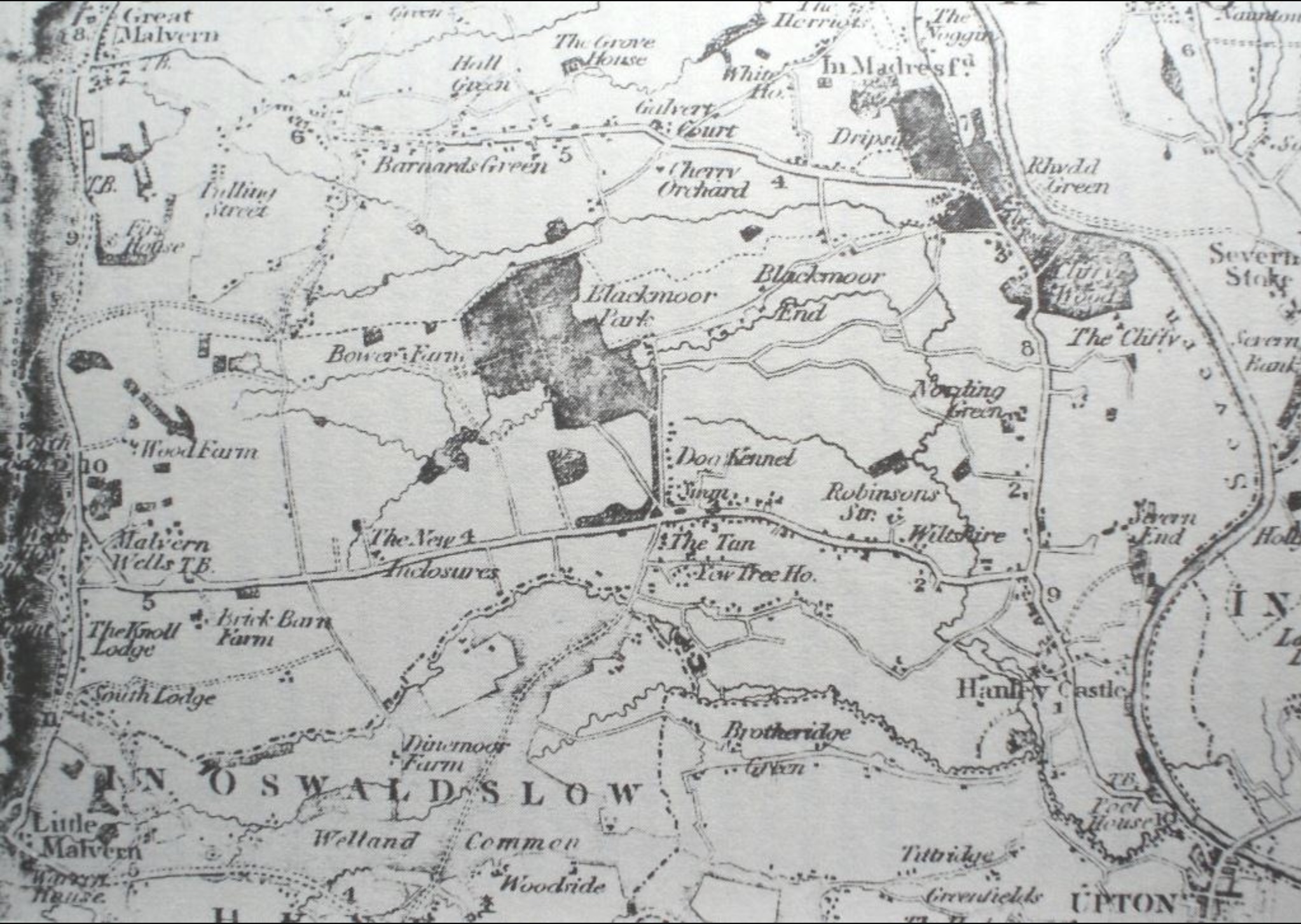
1822 Greenwood Map Hanley Castle
Census Returns
Here you will find census returns for Hanley Castle Parish for the period 1841 -1911. Parish information from the 1921 census data is not freely available from National Archives, so it is not possible to include it here. To view, click on the relevant date below to access a downloadable PDF.
1841 Hanley Castle Census Data
1851 Hanley Castle Census Data
1861 Hanley Castle Census Data
1871 Hanley Castle Census Data
1881 Hanley Castle Census Data
1891 Hanley Castle Census Data
1901 Hanley Castle Census Data
1911 Hanley Castle Census Data
Digitised Local History Mapping Tool
Following completion of the Hanley Castle digitised mapping project by Maggie Noke of the Worcestershire Historic Environment Service (as part of The Hanleys’ Village Society’s Heritage Lottery grant), it is now possible to zoom in on any site in the parish and see its boundaries and any building on it at the time of the 1795 Enclosure Act.
Then at the click of a mouse, transparent layers from other historic maps can be superimposed to show how the 18th-century layout compares with parish maps drawn in 1812, 1852, 1903 and the modern Ordinance Survey. Double-clicking on a particular spot brings a close-up outline of the parcel of land, together with whatever description was noted at the time of the Enclosure Award in 1797.
In addition, the Lechmere-Hornyold exchange map of 1873 can be substituted for the 1797 map to show the lands that were exchanged between the two families to consolidate their respective holdings in the east and west of the parish.
To access the tool, go to: Worcestershire Mapping
Local history links
Lascelle’s Directory entry for Hanley Castle
Photographs of Hanley Castle graves on Parish Mouse
Malvern Family History Society